Auchtermuchty Church
For more pictures of the church please visit the church's own web site at
https://www.edensheadparishchurch.co.uk
The "Cross" Auchtermuchty
This is the town square, known in Auchtermuchty as "The Cross", a memory of the time when the market cross stood here.
Auchtermuchty War Memorial
The War Memorial commemorates the men of Auchtermuchty who fell in the First and Second World Wars.
For a closer look at the names on the Memorial click here.
Muchty in Bloom
Around the town are many planters and flower boxes planted and maintained by the volunteers of "Muchty in Bloom" and supported by donations from local individuals and businesses.
Burnside is one of the main routes through the town.
Burnside
Distillery Street is the site of the long gone Auchtermuchty Distillery, one of the victims of US prohibition!
Another view of Distillery Street showing the Auchtermuchty Community Centre
Distillery Street
The corner of the High Street and Low Road provides a pleasant spot to sit and enjoy the flowers.
The High Street
Muchty in Winter
This bleak view of a snow clad Muchty shows West Lomond in the background,
Muchty in Summer
While this more colourful view shows the farmer hard at work gathering in the harvest.
Station Road
This view of Station Road shows the Royal Burgh of Auchtermuchty sign and the burgh's coat of arms.
The sign was designed and paid for by the Auchtermuchty Community Association.
Beside the road is the Station Road Park, formerly known as the Town park.
Low Road Park
THe other main park in the town is the Low Road Park.
Sir Jimmy Shand
Sir Jimmy Shand MBE MA
28th January 1908 -
23rd December 2000
The bronze sculpture of Auchtermuchty's most famous resident was unveiled by the Rt Hon Earl of Elgin on Friday 12th September 2003.
Although not originally from 'Muchty, Jimmy had long made his home here and to Scots worldwide the names "Auchtermuchty" and "Jimmy Shand" were virtually synonymous.
Jimmy was Scotland's most famous accordionist and leader of the Jimmy Shand Band and composer of favourites such as the "Bluebell Polka".
The sculpture by David Annand is located in a small garden just off the Newburgh Road, just up from the Auchtermuchy Community Centre.
For more information please visit his official web site at www,jimmyshand.com
Archibald Findlay
Another of Auchtermuchty's famous inhabitants was Archibald Findlay who developed strains of patatoes from which most of the world's potatoes are grown today.
A plaque in Upper Greens marks where he had his workshop and warehouse.
Macduff House
Macduff House in the High Street is the oldest house in Auchtermuchty.
The Boar's Head, Auchtermuchty's award winning gastro-pub!
https://www.theboarsheadfife.co.uk
Boundary Stone, Mournipea
At various stages in the history of Auchtermuchty the Town Council sold off bits of common land to raise money. As a result the boundaries of the burgh kept shrinking. The boundary marker shown below indicates where the boundary lay in 1797.
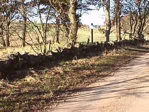
Mourmipea is the road which leads out of Auchtermuchty towards Pitmedden Forest and was at one time the main road to Perth.
The picture above shows part of Mournipea as it is today. The boundary stone forms part of the wall or "dyke" and lies at the base of the tree in the mid-foreground.


